Confirm hours before travelling: the Onelli page lists 9 am–9 pm, while the booking system specifies general entry from 8 am to 8 pm. Access depends on weather and which sectors are open.
Mandatory registration at Onelli
Ceferino Fonzo Visitor Centre is 10 km from the entrance. All visitors must register before exploring the park and report their departure.
Complete the Mountain Activity Register and report route changes or any extension of your visit to park staff.
The RP 37 approach includes about 90 km of gravel. Internal roads add more than 90 km: carry enough fuel for arrival, exploring and departure. There is no fuel or grocery store in the park.
Bring food, two spare wheels and tools. There is no scheduled bus into the park; arrange transport before departure.
For overnight routes, the terms require a stove, a tent suitable for wind and cold, a sleeping bag with a comfort rating between −10 °C and 0 °C, trekking footwear, layered clothing, a headlamp and a personal first aid kit.
Carry waterproof clothing, sun protection, food and water for your route. Snow is possible even in summer; check the forecast and trail conditions.
Fires, pets other than accredited guide dogs, unauthorised drones and loudspeakers are prohibited. Carry out all waste, including hygiene waste. Smoke only in authorised areas and never discharge soap, detergents or effluent into water.
Respect trails, closures, plants and wildlife. Do not feed animals or remove archaeological objects. Hunting, fishing, boating and activities entering the water are prohibited.
Disinfect equipment that may contact water at authorised checkpoints to prevent didymo. Lakes and rivers are cold and deep; there are no authorised swimming areas.
In strong wind, avoid unstable trees and slopes with falling rocks. If you encounter a puma, stay calm, do not run or turn your back, and notify rangers.
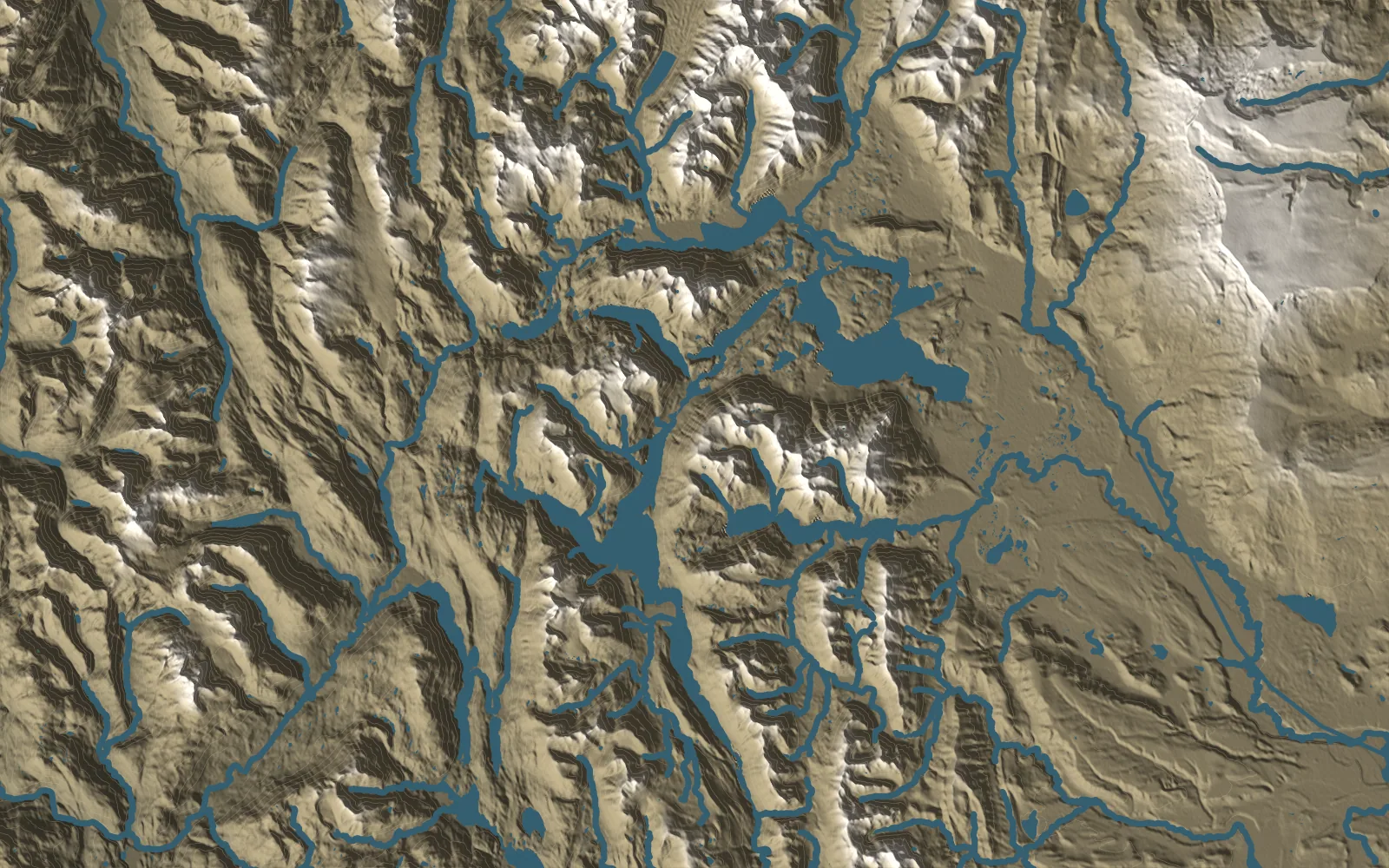
One of the country’s most remote parks: lakes Belgrano and Burmeister, snowy peaks, guanacos and rock art 10,000 years old, far from everything.
Highlights
The 3,706 m San Lorenzo massif, its glaciers and the wall overlooking the Río Lácteo valley and Laguna de los Témpanos.
The Azara rapids and their three viewpoints, near the namesake refuge, along the multi-day Azara Circuit.
The short and long Belgrano Peninsula loops, between sheltered bays and turquoise water.
The multi-day Azara Circuit, linking refuges through steppe and lenga forest.
The Río Lácteo valley and Laguna de los Témpanos beneath the San Lorenzo massif.
Birdwatching at Lagunas del Mié and the views over Lake Burmeister.
Getting there
✈By plane
Aeropuerto Internacional Comandante Armando Tola, El Calafate (FTE)
One option is to fly to El Calafate and continue overland along the RN 40 corridor. The park's official website gives about 500 km and an 8–9 hour drive to the park: arrange a vehicle or transfer and allow a day for the journey. Check flights and road conditions before travelling.
⛰By car
RN 40 · RP 37
From Gobernador Gregores, follow RN 40 and RP 37 for about 220 km, including 90 km of gravel. Register at Onelli before using the internal roads. The northern RP 41 approach from Lago Posadas has recently opened: it is little more than a track, for 4WD only and preferably with a second vehicle, taking 5–6 hours.
◍By bus
Gobernador Gregores
APN lists Taqsa services to Gobernador Gregores, with connections towards Perito Moreno and Piedra Buena. Arrange a vehicle or authorised transfer for the remaining 220 km; do not assume there is a scheduled bus into the park.
Book overnight stops and arrange access before setting out
Check in and check out at Onelli ranger station
The season runs from 1 October to 30 April, subject to weather and open sectors. Register arrival and departure at Onelli (Ceferino Fonzo Visitor Centre). The booking system lists general entry from 8 am to 8 pm; the Onelli page lists 9 am to 9 pm. Confirm hours before travelling.
Book each night in the official system: choose the sector, refuge, dome or pitch and dates, complete the visitor registration and pay. Places often sell out weeks ahead. Send questions and cancellations (at least 24 hours before, quoting your booking number) to reservasperitomoreno@bancodebosques.org, Monday to Friday, 8 am–3 pm. Also complete the mandatory mountain registration. Refuges are shared; bring a sleeping bag, cooking equipment and supplies.
Refuel and buy food before the approach: the park has no filling station, tyre repair shop or grocery store. Arrange arrival, departure and internal transfers with a vehicle or authorised driver. WiFi is limited to Onelli; download maps.
Allow 3–5 days for Azara and 2–3 days for Río Lácteo with Laguna de los Témpanos. Trail hours indicate walking time at about 2.5 km/h, except where the official website publishes its own time, and exclude nights and long breaks. Elevation figures come from the map linked by APN; they are approximate and do not replace ranger advice about crossings and closures.
A 3–4 hour loop from the isthmus, 10 km by road from Onelli. It crosses the peninsula's interior and shares sections with the longer loop. Cumulative ascent is not published for this variant; check trail conditions and book ahead if staying overnight.
Registration required
Distance
9.6 km
Duration
3.8 h
Elevation gain
—
Difficulty
Moderate
Loop
Península Belgrano · Circuito Grande
A 5–6 hour loop along the peninsula's shores overlooking Lake Belgrano, as timed by the official website. APN's map gives 270 m of cumulative ascent. Refuge access spurs may add distance; book before using them.
Registration required
Distance
16.8 km
Duration
6 h
Elevation gain
270 m
Difficulty
Hard
Loop
Circuito Azara
A 3–5 day trek from the Azara/Puesto 9 car park via Tucúquere, La Angostura and Azara. The 21 hours estimate total walking time at about 2.5 km/h, the official Río Lácteo pace, excluding nights; official sources give no times per section. About 910 m of cumulative ascent, adding APN map sections and the return approach; refuge spurs change the total. Book each overnight stop.
Registration required
Distance
52 km
Duration
20.8 h
Elevation gain
910 m
Difficulty
Hard
Loop
Valle del Río Lácteo · Refugio Doug y Krist Tompkins
From the valley car park to the refuge: about 11.5 km and 4–5 hours each way. The 23 km and about 9 hours include the return; an overnight booking allows two days. Round-trip ascent adds the outward APN profile's 323 m ascent and 268 m descent. Add the Témpanos trail to reach the lagoon.
Registration required
Distance
23 km
Duration
9.2 h
Elevation gain
591 m
Difficulty
Hard
Out and back
Laguna de los Témpanos
An extension from Doug and Krist Tompkins refuge to the lagoon viewpoint: 5.2 km and 2–3 hours each way. It excludes the 23 km return approach along Río Lácteo. APN's approximate outward profile lists 134 m ascent and no descent. River crossings require checking conditions. APN excludes children under 13 from this section. Allow 2–3 days for the full route from the car park.
Registration required
Distance
10.4 km
Duration
4.2 h
Elevation gain
134 m
Difficulty
Hard
Out and back
Mirador Lago Belgrano
A 2–3 hour loop along the lake's southern shore and woodland near René Negro. The official website gives 8.5 km and 2–3 hours; the APN map records about 8.4 km and 122 m ascent. The car park is about 11 km from Onelli. Some sections are very exposed to wind: park facing the prevailing westerly wind and take care with children or older walkers.
Registration required
Distance
8.5 km
Duration
3 h
Elevation gain
122 m
Difficulty
Moderate
Loop
Cerro León
A panoramic ascent to the 1,405 m summit from the car park near El Rincón, about 16 km from Onelli: roughly 3 km and 2 hours straight up to the shoulder; the 6 km listed here includes the return: about 3½ hours, with the official 2 hours up plus the descent. Its map lists 479 m ascent. A more gradual 7 km, 3–4 hour variant starts near Hostería La Oriental. Avoid the climb in strong wind.
Registration required
Distance
6 km
Duration
3.5 h
Elevation gain
479 m
Difficulty
Hard
Out and back
Mirador Lago Volcán
Walk 400 m each way to the Lago Volcán and Lagos Escondidos viewpoints, overlooking the Lácteo and Volcán rivers. Allow about 20 minutes, an indicative estimate. Cumulative ascent is not published. The Cañadón del Río Volcán car park is about 24 km from Onelli, on the road to El Rincón.
Registration required
Distance
0.8 km
Duration
0.3 h
Elevation gain
—
Difficulty
Easy
Out and back
Pasarela Histórica del Río Volcán
From the car park shared with the viewpoint, walk 500 m to the historic former livestock footbridge site, passing Playa del Viento, then a 300 m extension along the canyon to Playa de la Brisa. Distance includes the return; the official website allows 45 minutes to the footbridge; at the guide's pace the walk takes about 40 minutes in total. APN's map lists 12 m of elevation change. The mapped track reaches the former footbridge (about 500 m); ask at Onelli whether the extension is open.
Registration required
Distance
1.6 km
Duration
0.6 h
Elevation gain
12 m
Difficulty
Easy
Out and back
Mirador Lago Burmeister
From the camping area about 16 km from Onelli, walk 600 m along the northern shore to the viewpoint and return. The official website rates it as difficult and allows about 20 minutes each way: the final slope and wind require care. The map profile and elevation markers disagree, so cumulative ascent is omitted here. Avoid the rock in windy conditions.
Registration required
Distance
1.2 km
Duration
0.5 h
Elevation gain
—
Difficulty
Hard
Out and back
Distances, elevation gain and times are approximate and change with the season. Check each trail’s status with the park before setting out.
Where to stay
Refuges, domes and campsites are booked in the park's official system (Banco de Bosques). Go to the booking system ↗
Mountain hut$
Refugio Caleta Huala
Península Belgrano
A shared refuge for 4–6 people, with no adjoining camping pitches. One night; about 800 m from the car park, near the start of the short peninsula loop. Walk-in access and advance booking. Bring a sleeping bag, stove and utensils.
A shared 3-person refuge. Up to two non-consecutive nights to complete the circuit. Domes and camping in this sector. Walk-in access and advance booking. Bring a sleeping bag, stove and utensils.
A shared 3-person refuge. Up to two consecutive nights; three domes and the 12-pitch San Lorenzo camping area in this sector. Walk-in access and advance booking. Bring a sleeping bag, stove and utensils.
Rustic camping booked in advance through the official system: 3 camping pitches, a latrine and 3 motorhome pitches. Pitches are unnumbered and chosen on arrival. Motorhomes: up to 3 consecutive nights according to the official website (the booking terms say 4; confirm when booking). No shop. Open fires are prohibited; use a stove.
An estancia accommodation option within the park, listed by APN, with a main house, cabin and dormitory rooms. It is the only lodge inside the park, run by its owners; home-cooked meals are served only with a booking. The official park website lists it among its bookable options: confirm opening dates, rates and availability before travelling; no verified price is listed.
Mountain hut$
Refugio Archipiélago
Península Belgrano
A shared 6-person refuge. One night; three adjoining camping pitches. Walk-in access and advance booking. Bring a sleeping bag, stove and utensils.
A shared 3-person refuge. One night; three camping pitches in the Playa Quetro sector. Walk-in access and advance booking. Bring a sleeping bag, stove and utensils.
A shared refuge for 4–6 people. One night; four camping pitches in this sector, beside the stream forded at the start of the trail. Walk-in access and advance booking. Bring a sleeping bag, stove and utensils.
3 camping pitches beside Archipiélago refuge, for up to 4 people per pitch. Walk-in access and advance booking. Bring your own tent and stove. The map marks the refuge sector.
3 camping pitches beside Dos Bahías refuge, for up to 4 people per pitch. Walk-in access and advance booking. Bring your own tent and stove. The map marks the refuge sector.
3 camping pitches beside Playa Quetro refuge, for up to 4 people per pitch. Walk-in access and advance booking. Bring your own tent and stove. The map marks the refuge sector.
2 camping pitches beside René Negro refuge, for up to 4 people per pitch. Walk-in access and advance booking. Bring your own tent and stove. The map marks the refuge sector.
1 camping pitch beside Tucúquere refuge, for up to 4 people per pitch. Walk-in access and advance booking. Bring your own tent and stove. The map marks the refuge sector.
3 camping pitches beside La Angostura refuge, for up to 4 people per pitch. Walk-in access and advance booking. Bring your own tent and stove. The map marks the refuge sector.
3 camping pitches beside Azara refuge, for up to 4 people per pitch. Walk-in access and advance booking. Bring your own tent and stove. The map marks the refuge sector.
4 camping pitches beside Gilberto refuge, for up to 4 people per pitch. Walk-in access and advance booking. Bring your own tent and stove. The map marks the refuge sector.
12 camping pitches on the Roca Azul section of the Azara Circuit, near Tucúquere. Up to 4 people per pitch. Walk-in access only and advance booking. Bring a tent and stove; a latrine is available.
12 camping pitches at the head of the Río Lácteo valley, near Tompkins refuge and the route to Laguna de los Témpanos. Up to 4 people per pitch. Walk-in access only and advance booking. Bring a tent and stove; a latrine is available.
Camping area with dormis on the grounds of Estancia La Oriental, near the Cerro León and La Condorera trailheads. Contact the estancia for availability, facilities and booking. The map marks the property.
2 shared domes beside the refuge, with 6 beds in total. Access on foot; advance booking required. Bring a sleeping bag, stove and mountain equipment. The map marks the refuge sector; each dome's position within the group is illustrative.
Valle del Río Lácteo · sector Kris & Doug Tompkins
3 shared domes beside the refuge, for 1–4 people each. Access on foot; advance booking required. Bring a sleeping bag, stove and mountain equipment. The map marks the refuge sector; each dome's position within the group is illustrative.
Fuera del parque · a mitad de camino desde El Calafate
A stop to split the drive from El Calafate: it is on the way, about 375 km from El Calafate and about 160 km from Onelli. Check availability, meals and rates directly with the estancia; no verified price is listed.
Carry waterproof layers, wind protection, food and safe drinking water. Snow is possible even in summer. Check water supplies before walking.
Fishing, boating, swimming and kayaking are prohibited. Visit the lakes from authorised trails and viewpoints.
Do not light fires or bring pets; carry out all waste. Disinfect footwear and poles to help prevent the spread of didymo.
Watch guanacos, rheas and birds from a distance. Huemul sightings are not guaranteed. Respect ropes and closures at archaeological sites.
Plan your journey to Perito Moreno
We design private trips at each traveller’s pace: hikes, local guides and carefully chosen stays. Tell us what you have in mind and we’ll reply within 48 hours.